Saint Paul, Minnesota
 City of Saint Paul |
|||
|---|---|---|---|
| — City — | |||
 |
|||
|
|||
| Nickname(s): "The Capital City", "The Saintly City", "Pig's Eye", "The Silver City" | |||
| Motto: The most livable city in America.1 | |||
 |
|||
 |
|||
| Coordinates: | |||
| Country | United States | ||
| State | Minnesota | ||
| County | Ramsey | ||
| Government | |||
| - Mayor | Chris Coleman (DFL) | ||
| Area | |||
| - City | 56.2 sq mi (145.5 km2) | ||
| - Land | 52.8 sq mi (136.7 km2) | ||
| - Water | 3.4 sq mi (8.8 km2) | ||
| Elevation | 702 ft (214 m) | ||
| Population (2000)[1] | |||
| - City | 287,151 | ||
| - Density | 5,438/sq mi (2,100.6/km2) | ||
| - Metro | 3,502,891 | ||
| - Demonym | Saint Paulite | ||
| Time zone | CST (UTC-6) | ||
| - Summer (DST) | CDT (UTC-5) | ||
| ZIP codes | 55101–55175 | ||
| Area code(s) | 651 | ||
| Website | www.stpaul.gov | ||
| 1Current as of July 30, 2008.[2] | |||
Saint Paul (pronounced /ˌseɪnt ˈpɔːl/, abbreviated St. Paul) is the capital and second-most populous city of the U.S. state of Minnesota. The city lies mostly on the north bank of the Mississippi River, downstream of the river's confluence with the Minnesota River, and adjoins Minneapolis, the state's largest city. Known as the "Twin Cities", these two cities form the core of Minneapolis-Saint Paul, the 13th largest metropolitan area in the United States, with about 3.5 million residents.[3] The city's population at the 2000 census was 287,151.[1] Saint Paul serves as the county seat of Ramsey County, the smallest and most densely populated county in Minnesota.[4]
Founded near historic Native American settlements as a trading and transportation center, the city rose to prominence when it was named the capital of the Minnesota Territory in 1849. Though Minneapolis is more nationally recognized, Saint Paul contains important institutions and the state's political activity.[5] Regionally, the city is popular for the Xcel Energy Center, home of the Minnesota Wild,[6] and for the Science Museum of Minnesota.[7][8] As a business hub of the Upper Midwest, it is headquarters for companies such as Ecolab and Lawson Software.[9] St. Paul, along with its Twin City, Minneapolis, is known for its high literacy rate. It is the only city in the US, with a population of 250,000 or more, to increase the circulation number of Sunday newspapers in 2007.
The settlement originally began at present-day Lambert's Landing but was referred to as Pig's Eye, when Pierre "Pig's Eye" Parrant established a popular tavern there. When Fr. Lucien Galtier, the first Catholic pastor of the region, established the Log Chapel of St. Paul (shortly thereafter to become the first location of the Cathedral of St. Paul), he made it known that the settlement was now to be called by that name, as "St. Paul as applied to a town or city was well appropriated, this monosyllable is short, sounds good, it is understood by all Christian denominations...".[10]
Contents |
History
Burial mounds in present-day Indian Mounds Park suggest the area was originally inhabited by the Hopewell Native Americans about two thousand years ago.[11][12] From the early 17th century until 1837 the Mdewakanton Dakota, a tribe of the Sioux, lived near the mounds after fleeing their ancestral home of Mille Lacs Lake from advancing Ojibwe.[11][13] They called the area I-mni-za ska dan ("little white rock") from the exposed white sandstone cliffs.[14][15]

Following the Louisiana Purchase in 1803, a U.S. Army officer named Zebulon Pike negotiated for approximately 100,000 acres (400 km2; 160 sq mi) of land from the local Dakota tribes in 1805 for the establishment of a fort. The territory was located on both banks of the Mississippi River starting from Saint Anthony Falls in present-day Minneapolis to the confluence with the Saint Croix River.[16] Fort Snelling was built on the territory in 1819 at the confluence of the Mississippi and Minnesota Rivers, which formed a natural barrier to both Native American nations. The 1837 Treaty with the Sioux ceded all local tribal land east of the Mississippi to the U.S. Government.[17] Taoyateduta (Chief Little Crow V) moved his band at Kaposia across the river to the south.[18][19] Fur traders, explorers, and missionaries came to the area for the fort's protection. Many of the settlers were French-Canadians and lived nearby. However, as a whiskey trade flourished, military officers banned settlers from the fort-controlled lands. Pierre "Pig's Eye" Parrant, a retired fur trader-turned-bootlegger who particularly irritated officials,[20] set up his tavern, the Pig's Eye, near present-day Lambert's Landing.[15] By the early 1840s, the community had become important as a trading center and a destination for settlers heading west. Locals called the area Pig's Eye (French: L'Oeil du Cochon) or Pig's Eye Landing after Parrant's popular tavern.[20]
In 1841, Father Lucien Galtier was sent to minister to the Catholic French-Canadians and established a chapel on the bluffs above Lambert's Landing named for his favorite saint, Paul the Apostle.[21][22] Galtier intended for the settlement to adopt the name Saint Paul in honor of the new chapel.[20] In 1847 a New York educator named Harriet Bishop moved to the area and opened the city's first school.[23] The Minnesota Territory was formalized in 1849 and Saint Paul named as capital. In 1857, the territorial legislature voted to move the capital to Saint Peter. However, Joe Rolette, a territorial legislator, stole the physical text of the approved bill and went into hiding, thus preventing the move.[24] On May 11, 1858, Minnesota was admitted to the union as the thirty-second state with Saint Paul as the capital.
That year, more than 1,000 steamboats were in service at Saint Paul,[23] making the city a gateway for settlers to the Minnesota frontier or Dakota Territory. Natural geography was a primary reason the city became a landing. The area was the last accessible point to unload boats coming upriver due to the Mississippi River valley's stone bluffs. During this period, Saint Paul was called "The Last City of the East."[25] James J. Hill constructed and expanded his network of railways into the Great Northern Railway and Northern Pacific Railway, which were headquartered in Saint Paul. Today they are the BNSF Railway.[25]
On August 20, 1904, severe thunderstorms and tornadoes damaged hundreds of downtown buildings causing USD $1.78 million (1904) in damages in the city and ripping spans from the High Bridge.[26] In the 1960s during urban renewal, Saint Paul razed western neighborhoods close to downtown.[27] The city also contended with creation of the interstate freeway system in a fully built landscape.[28] From 1959 to 1961, the western Rondo neighborhood was obliterated by the construction of Interstate 94 and brought attention to racial segregation and unequal housing in northern cities.[29][30] The Rondo Days celebration annually commemorates the African American community.[31]
Downtown had short skyscraper booms beginning in the 1970s. The tallest buildings were constructed in the late 1980s such as Galtier Plaza (Jackson and Sibley Towers), The Pointe of Saint Paul condominiums, and the city's tallest building Wells Fargo Place (formerly Minnesota World Trade Center).[32] The 1990s to 2000s continued the tradition of ushering in new immigrant groups. As of 2004, nearly 10% of the city's population were recent Hmong immigrants from Vietnam, Laos, Cambodia, Thailand, and Myanmar.[33]
Geography

Saint Paul history and the city's growth as a landing port are tied to water. The city's defining physical characteristic, the Mississippi and connecting Minnesota Rivers were carved into the region during the last ice age. Fed by receding glaciers and Lake Agassiz ten thousand years ago, torrents of water from a glacial river undercut the river valleys.[34] The city is situated in east-central Minnesota.
The Mississippi River forms a municipal boundary on part of the city's west, southwest and southeast sides. Minneapolis, the state's largest city lies to the west; Falcon Heights, Lauderdale, Roseville, and Maplewood are north; Maplewood is also to the east; the cities of West Saint Paul and South Saint Paul are to the south; and Lilydale, Mendota and Mendota Heights lie across the river from the city to the south. The city's largest lakes are Pig's Eye Lake, in the river, Lake Phalen, and Lake Como. According to the United States Census Bureau, the city has a total area of 56.2 square miles (145.5 km²). 52.8 square miles (136.7 km²) of it is land and 3.4 square miles (8.8 km²) of it (6.07%) is water.[35]
Neighborhoods
Saint Paul's Department of Planning and Economic Development divides Saint Paul into 17 Planning Districts, created in 1979 to allow neighborhoods to participate in governance and utilize Community Development Block Grants. With a funding agreement directly from the city, the councils share a pool of funds.[36] The councils have significant land-use control, a voice in guiding development, and they organize residents.[37] The boundaries are adjusted depending on population changes, as such, they sometimes overlap established neighborhoods.[38] Though these neighborhoods changed overtime, many of their historically-significant structures have been saved by preservationists.
The city's seventeen Planning Districts are:
- 1. Sunray-Battle Creek-Highwood
- 2. Greater East Side
- 3. West Side
- 4. Dayton's Bluff
- 5. Payne-Phalen
- 6. North End
- 7. Thomas Dale (Frogtown)
- 8. Summit-University
- 9. West End
- 10. Como (Como Park)
- 11. Hamline-Midway
- 12. Saint Anthony Park
- 13. Union Park
- 14. Macalester-Groveland
- 15. Highland (Highland Park)
- 16. Summit Hill
- 17. Downtown
- 18. Hillcrest (White Bear and Iowa)
Climate
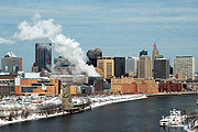
Saint Paul has a continental climate typical of the Upper Midwestern United States. Winters are frigid and snowy, while summer is hot and humid. As a consequence of St. Paul's continental climate it experiences one of the greatest ranges of temperatures on earth for any major city. On the Köppen climate classification, Saint Paul falls in the warm summer humid continental climate zone (Dfa). The city experiences a full range of precipitation and related weather events, including snow, sleet, ice, rain, thunderstorms, tornadoes and fog.
Due to its northerly location in the United States and lack of large bodies of water to moderate the air, Saint Paul is sometimes subjected to cold Arctic air masses, especially during late December, January and February. The average annual temperature of 45.4 °F (7 °C) gives the Minneapolis–Saint Paul metropolitan area the coldest annual mean temperature of any major metropolitan area in the continental U.S.[39]
| Climate data for Saint Paul, Minnesota | |||||||||||||
|---|---|---|---|---|---|---|---|---|---|---|---|---|---|
| Month | Jan | Feb | Mar | Apr | May | Jun | Jul | Aug | Sep | Oct | Nov | Dec | Year |
| Record high °F (°C) | 57 (13.9) |
59 (15) |
83 (28.3) |
93 (33.9) |
93 (33.9) |
100 (37.8) |
105 (40.6) |
103 (39.4) |
95 (35) |
88 (31.1) |
75 (23.9) |
66 (18.9) |
105 |
| Average high °F (°C) | 23 (-5) |
30 (-1.1) |
42 (5.6) |
58 (14.4) |
71 (21.7) |
79 (26.1) |
83 (28.3) |
81 (27.2) |
72 (22.2) |
59 (15) |
41 (5) |
27 (-2.8) |
55.5 (13.06) |
| Average low °F (°C) | 6 (-14.4) |
13 (-10.6) |
24 (-4.4) |
36 (2.2) |
48 (8.9) |
58 (14.4) |
63 (17.2) |
61 (16.1) |
52 (11.1) |
40 (4.4) |
26 (-3.3) |
12 (-11.1) |
36.6 (2.55) |
| Record low °F (°C) | -29 (-33.9) |
-32 (-35.6) |
-25 (-31.7) |
3 (-16.1) |
21 (-6.1) |
36 (2.2) |
45 (7.2) |
42 (5.6) |
26 (-3.3) |
15 (-9.4) |
-14 (-25.6) |
-29 (-33.9) |
-32 |
| Precipitation inches (mm) | 1.02 (25.9) |
0.78 (19.8) |
1.92 (48.8) |
2.54 (64.5) |
3.73 (94.7) |
4.98 (126.5) |
4.41 (112) |
4.37 (111) |
3.20 (81.3) |
2.51 (63.8) |
2.09 (53.1) |
1.04 (26.4) |
32.59 (827.8) |
| Source: The Weather Channel [40] | |||||||||||||
Demographics
| U.S. Census | |
|---|---|
| Year | Pop. |
| 1860 | 10,401 |
| 1870 | 20,030 |
| 1880 | 41,473 |
| 1890 | 133,156 |
| 1900 | 163,065 |
| 1910 | 214,744 |
| 1920 | 234,698 |
| 1930 | 271,606 |
| 1940 | 287,736 |
| 1950 | 311,349 |
| 1960 | 313,411 |
| 1970 | 309,980 |
| 1980 | 270,230 |
| 1990 | 272,235 |
| 2000 | 287,151 |
| Est. 2009 | 287,501 |

The earliest known inhabitants from about 400 A.D. were members of the Hopewell tradition who buried their dead in mounds (now Indian Mounds Park) on the bluffs above the river. The next known inhabitants were the Mdewakanton Dakota in the 17th century who fled their ancestral home of Mille Lacs Lake in central Minnesota in response to westward expansion of the Ojibwe nation.[13] The Ojibwe would later occupy the north (east) bank of the Mississippi River.
By 1800, French Canadian explorers came through the region and attracted fur traders to the area. Fort Snelling and nearby Pig's Eye Tavern also brought the first Yankees from New England and English, Irish, and Scottish immigrants who had enlisted in the army and settled nearby after discharge. These early settlers and entrepreneurs built houses on the heights north of the river. The first wave of immigration came with the Irish who settled at Connemara Patch along the Mississippi, named for their home in Connemara Ireland. The Irish would become prolific in politics, city governance, and public safety much to the chagrin of the Germans and French who had grown into the majority. In 1850, the first of many waves of Swedish immigrants passed through Saint Paul on their way to farming communities in northern and western regions of the territory. A large group settled in Swede Hollow which would later become home to Poles, Italians and Mexicans. The last Swedish presence had moved up Saint Paul's East Side along Payne Avenue in the 1950s.[41]
In terms of people who specified European ancestry in the 2005-2007 American Community Survey, the city was 26.4% German, 13.8% Irish, 8.4% Norwegian, 7.0% Swedish, and 6.2% English. There is also a visible community of people of Sub-Saharan African ancestry, representing 4.2% of St. Paul's population.[42] By the 1980s, the Thomas Dale area, once a Austro-Hungarian enclave known as Frogtown (German: Froschburg), became home to Vietnamese people who left their war-torn country. Soon after a settlement program for the Hmong diaspora came and by 2000, the Saint Paul Hmong were the largest urban contingent in the United States.[43][44][45] Mexican immigrants have settled in Saint Paul's West Side since the 1930s, and have grown enough that Mexico opened a foreign consulate in the 2005.[46][47]
The majority of residents claiming religious affiliation are Christian, split between the Roman Catholic Church and various Protestant denominations. The Roman Catholic presence comes from Irish, German, Scottish, and French Canadian settlers who in time would be bolstered by Hispanic immigrants. There are Jewish synagogues such as Mount Zion Temple and relatively small populations of Hindus, Muslims, Buddhists, and Pagans.
As of the 2005-2007 American Community Survey conducted by the U.S. Census Bureau, White Americans made up 66.5% of Saint Paul's population; of which 62.1% were non-Hispanic whites. Blacks or African Americans made up 13.9% of Saint Paul's population; of which 13.5% were non-Hispanic blacks. American Indians made up 0.8% of Saint Paul's population; of which 0.6% were non-Hispanic. Asian Americans made up 12.3% of Saint Paul's population; of which 12.2% were non-Hispanic. Pacific Islander Americans made up less than 0.1% of Saint Paul's population. Individuals from some other race made up 3.4% of Saint Paul's population; of which 0.2% were non-Hispanic. Individuals from two or more races made up 3.1% of Saint Paul's population; of which 2.6% were non-Hispanic. In addition, Hispanics and Latinos made up 8.7% of Saint Paul's population.[48][49]
As of the 2000 U.S. Census,[1] there were 287,151 people, 112,109 households, and 60,999 families residing in the city.[50] The racial makeup of the city was 67.0% White, 11.7% African American, 1.1% Native American, 12.4% Asian (mostly Hmong and Vietnamese), 0.07% Pacific Islander, 3.8% from other races, and 3.9% from two or more races. Hispanic or Latino of any race were 7.9% of the population.[51]
There were 112,109 households, out of which 29.1% had children under the age of 18 living with them, 36.1% were married couples living together, 13.9% had a female householder with no husband present, and 45.6% were non-families. 35.9% of all households were made up of individuals and 9,4% had someone living alone who was 65 years of age or older. The average household size was 2.46 and the average family size was 3.32.
In the city the population was spread out with 27.1% under the age of 18, 12.5% from 18 to 24, 32.0% from 25 to 44, 18.0% from 45 to 64, and 10.3% who were 65 years of age or older. The median age was 31 years. For every 100 females there were 93.6 males. For every 100 females age 18 and over, there were 89.5 males.
The median income for a household in the city was $38,774, and the median income for a family was $48,925. Males had a median income of $35,111 versus $29,432 for females. The per capita income for the city was $20,216. About 11.7% of families and 15.6% of the population were living below the poverty line, including 23.2% of those under age 18 and 9.7% of those age 65 or over.
Economy
The Minneapolis-Saint Paul-Bloomington area employs 1,570,700 people in the private sector as of July 2008, 82.43 percent of which work in private service providing-related jobs.[52]
Major corporations headquartered in Saint Paul include Ecolab, a chemical and cleaning product company[53] which was named in 2008 by the Minneapolis / St. Paul Business Journal as the eighth best place to work in the Twin Cites for companies with 1,000 full-time Minnesota employees,[54] Securian Financial Group Inc.,[55] Lawson Software, a business software and support company,[56] and Gander Mountain, a retailer of sporting goods which operates 115 stores in 23 states.[57]
The 3M Company is often cited as one of Saint Paul's companies though it is located in adjacent Maplewood, Minnesota. 3M employs 16,000 people throughout Minnesota.[58] St. Jude Medical, a manufacturer of medical devices, is directly across the municipal border of Saint Paul in Little Canada[59] though the company's address is listed in Saint Paul.[60]
The city is home to the Ford Motor Company's Twin Cities Assembly Plant, which it opened in 1924. Recently slated for closing, Ford now expects the plant to remain open through at least 2011 despite massive corporate losses.[61] The site is located in Highland Park on the Mississippi River adjacent to a company-owned dam, which generates hydroelectric power.[62]
Culture

In winter months, Saint Paul is active with the Saint Paul Winter Carnival, a tradition originating from 1886 when a New York reporter called Saint Paul "another Siberia." Attended by 350,000 visitors annually, the event showcases ice sculpting, an annual treasure hunt, winter food, activities, and an ice palace.[63] Year round the Como Zoo and Conservatory and adjoining zoo and Japanese Garden are popular. The historic Landmark Center located in downtown Saint Paul hosts cultural and arts organizations. The city's notable recreation locations include Indian Mounds Park, Battle Creek Regional Park, Harriet Island Regional Park, Highland Park, the Wabasha Street Caves, Lake Como, Lake Phalen, and Rice Park, as well as several areas abutting the Mississippi River.
The city is associated with the Minnesota State Fair located in nearby Falcon Heights as the fair grounds are just north of the Midway neighborhood and southeast of the University of Minnesota Saint Paul Campus. Though Fort Snelling is on the Minneapolis side of the Mississippi River bluff, the area including Fort Snelling State Park and Pike Island is managed by the Minnesota Department of Natural Resources headquartered in the city.[64]
Saint Paul is the birthplace of cartoonist Charles M. Schulz (Peanuts) who lived in Merriam Park from infancy until early 1960.[65] Schulz' Snoopy cartoon inspired decorated giant Peanuts sculptures around the city, a chamber of commerce promotion in the late 1990s.[66] Other notables include playwright August Wilson who lived in the city from 1978 until 1990. He wrote much of his decalogue of plays about the African-American experience in the 20th century during this time, premiering at the Penumbra Theatre. Other 20th century notables include renowned painter LeRoy Neiman and photographer John Vachon.[67]

The Ordway Center for the Performing Arts hosts theater productions and the Minnesota Opera is a founding tenant.[68] RiverCentre, attached to Xcel Energy Center, serves as the city's convention center. The city has contributed to the music of Minnesota and the Twin Cities music scene through various venues. Great jazz musicians have passed through the influential Artists' Quarter, first established in the 1970s in Whittier, Minneapolis until it moved to downtown Saint Paul in 1994.[69] Artists' Quarter also hosts the Soapboxing Poetry Slam, home of the 2009 National Poetry Slam Champions. The Turf Club in Midway has been a music scene landmark since the 1940s.[70] St. Paul is also the home base for the internationally acclaimed Rose Ensemble.[71] As an Irish stronghold, the city boasts popular Irish pubs with live music such as Shamrocks, The Dubliner and O'Gara's. The internationally acclaimed Saint Paul Chamber Orchestra is the nation's only full-time professional chamber orchestra.[72] The Minnesota Centennial Showboat on the Mississippi River began in 1958 with Minnesota's first centennial celebration.[73]
Saint Paul hosts a number of museums including the University of Minnesota's Goldstein Museum of Design;[74] The Minnesota Children's Museum;[75] The Schubert Club Museum of Musical Instruments;[76][77] The Minnesota Museum of American Art;[78][79] The Traces Center for History and Culture;[80] The Minnesota History Center; The Alexander Ramsey House; The James J. Hill House; The Minnesota Transportation Museum; The Science Museum of Minnesota; and The Twin City Model Railroad Museum.
Media
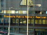
Residents of Saint Paul can receive 10 broadcast television stations, five of which broadcast from within Saint Paul. One daily newspaper, the St. Paul Pioneer Press, two weekly neighborhood newspapers, the East Side Review and City Pages (Village Voice Media), and several monthly or bi-monthly neighborhood papers serve the city. Several media outlets based in neighboring Minneapolis also serve the Saint Paul community, including the Star Tribune. And the magazine, Saint Paul Illustrated is published in Bloomington.
Saint Paul is home to Minnesota Public Radio, a three-format system that broadcasts on nearly 40 stations[81] around the Midwest. MPR locally delivers news and information, classical, and The Current (which plays a wide variety of music). The station regionally has 94,000 members and more than 800,000 listeners each week throughout the Upper Midwest, the largest audience of any regional public radio network.[82] Also operating as part of American Public Media, MPR's programming reaches 5 million listeners, most notably through A Prairie Home Companion hosted by Garrison Keillor, who also lives in the city.[82] The Fitzgerald Theater, renamed in 1994 for Irish native and novelist F. Scott Fitzgerald is home to the show.[83]
Sports
The Saint Paul division of Parks and Recreation runs over 1,500 organized sports teams.[84] In addition the Parks and Recreation department is responsible for 160 parks and 41 recreation centers.[85]
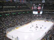
Saint Paul hosts a number of professional, semi-professional and amateur sports teams. The Minnesota Wild[6] and the Minnesota Swarm both play their home game in downtown Saint Paul's Xcel Energy Center, which was built for the Wild in 2000. The Wild brought the NHL back to Minnesota for the first time since 1993, when the Minnesota North Stars left the city for Dallas, Texas.[6] Citing the history of hockey in the Twin Cities and teams at all levels, Sports Illustrated affectionately called Saint Paul the new Hockeytown U.S.A. in 2007.[86]
The Xcel Energy Center, a multi-purpose entertainment and sports venue, can be converted to host concerts and accommodate nearly all sporting events. The Xcel Energy Center is located on the site of the demolished Saint Paul Civic Center. The Xcel Energy Center hosts the Minnesota high school boys hockey Tournament, Minnesota High School Girl's Volleyball Tournament and concerts though out the year. In 2004, it was named the best overall sports venue in the U.S. by ESPN.[87] Previously, the Minnesota Fighting Saints had played in Saint Paul from 1972 to 1977.
The St. Paul Saints is the city's semi-professional baseball team. Originally founded in 1884, they were shut down in 1961 after the Minnesota Twins moved to Minneapolis. The St. Paul Saints were brought back in 1993 as an independent baseball team in the Northern League of the American Association. Their home games are played at open-air Midway Stadium in Energy Park in the northwest section of the city.[88] Four noted Major League All Star baseball players are natives of Saint Paul: Hall of Fame outfielder Dave Winfield, Hall of Fame infielder Paul Molitor, pitcher Jack Morris and catcher Joe Mauer. The all black St. Paul Colored Gophers played four seasons in Saint Paul from 1907 to 1911.[89]
The St. Paul Twin Stars of the National Premier Soccer League play their home games at James Griffin Stadium.[90] The first curling club in Saint Paul was founded in 1888. The current club, the St. Paul Curling Club, was founded in 1912 and is the largest curling club in the United States.[91] The Minnesota RollerGirls are a flat-track roller derby league that is based in the Roy Wilkins Auditorium. Minnesota's oldest athletic organization, the Minnesota Boat Club resides in the Mississippi River on Raspberry Island. The club has produced world-class rowers for over a century.[92]
The Minnesota Timberwolves, Twins, and Vikings all play in Minneapolis.
| Professional Sports in Saint Paul | ||||
|---|---|---|---|---|
| Club | Sport | League | Venue | Championships |
| Minnesota Ripknees | Basketball | Premier Basketball League | Roy Wilkins Auditorium | |
| Minnesota Swarm | Indoor lacrosse | National Lacrosse League Eastern Division | Xcel Energy Center | |
| Minnesota Wild | Ice hockey | National Hockey League Western Conference | Xcel Energy Center | |
| Saint Paul Saints | Baseball | American Association North League | Midway Stadium | Northern League Championship: 1993, 1995, 1996, 2004 |
| St. Paul Twin Stars | Soccer | National Premier Soccer League Midwest Conference | James Griffin Stadium | |
Government and politics
Saint Paul is governed via a variation of the strong mayor-council form of government.[93] The mayor is the chief executive and chief administrative officer for the city and the seven member city council is the legislative body.[94][95] The mayor is elected by the entire city, while members of the city council are elected from seven different geographic wards, which have approximately equal populations.[96][97] Both the mayor and council members serve four-year terms.[98] The current mayor is Chris Coleman (DFL), who is unrelated to former mayor Norm Coleman. Coleman follows a long line of Irish mayors and he is the ninth since 1900. Aside from Norm Coleman (1994–2002) who became a Republican during his second term, Saint Paul has not elected a Republican mayor since 1952.[99]
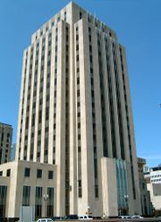
The city is also the county seat for Ramsey County, named for Alexander Ramsey the first state governor. The county once spanned much of the present-day metropolitan area and was originally to be named Saint Paul County after the city. Today it is geographically the smallest county and is the most densely populated.[4] As the only home rule county in Minnesota, the seven-member Board of Commissioners appoints a county manager whose office is in the combination city hall/county courthouse along with the Minnesota Second Judicial Courts.[100][101] The nearby Law Enforcement Center houses the Ramsey County Sheriff's office.
State and federal
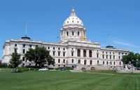
Saint Paul is the capital of the state of Minnesota. The city hosts the capitol building, designed by Saint Paul resident Cass Gilbert, and the House and Senate office buildings. The Minnesota Governor's Residence, which is used for some state functions, is on Summit Avenue. Minnesota's two major political parties are headquartered in Saint Paul: The Minnesota Democratic-Farmer-Labor Party (affiliated with the Democratic Party), and the Republican Party of Minnesota. Many state departments and services are headquartered throughout Saint Paul such as the Minnesota Department of Natural Resources.
The city is represented by 12 people in the Minnesota Legislature.[102][103] The latest biannual election was in 2008. At the Federal level, the city is in Minnesota's 4th congressional district, represented by Betty McCollum, a Democrat. In the Senate, Minnesota is represented by Amy Klobuchar, a former Hennepin County Attorney, a Democrat, and Al Franken, a former comedian and satirist, a Democrat.
| Minnesota House and Senate districts | |||||||||||||||||||||||||
|---|---|---|---|---|---|---|---|---|---|---|---|---|---|---|---|---|---|---|---|---|---|---|---|---|---|
| Senate | House | ||||||||||||||||||||||||
| Name | Took office | Party | Name | Took office | Party | ||||||||||||||||||||
| 64 | Dick Cohen | 1986 | DFL | 64A | Erin Murphy | 2006 | DFL | ||||||||||||||||||
| 64B | Michael Paymar | 1996 | DFL | ||||||||||||||||||||||
| 65 | Sandy Pappas | 1990 | DFL | 65A | Cy Thao | 2002 | DFL | ||||||||||||||||||
| 65B | Carlos Mariani | 1990 | DFL | ||||||||||||||||||||||
| 66 | Ellen Anderson | 1992 | DFL | 66A | John Lesch | 2002 | DFL | ||||||||||||||||||
| 66B | Alice Hausman | 1989 | DFL | ||||||||||||||||||||||
| 67 | Mee Moua | 2002 | DFL | 67A | Tim Mahoney | 1998 | DFL | ||||||||||||||||||
| 67B | Sheldon Johnson | 2000 | DFL | ||||||||||||||||||||||
Note: Ellen Anderson and Alice Hausman also represent Falcon Heights.
Education
Saint Paul is second in the United States in the number of higher education institutions per capita.[104] Higher education institutions that call Saint Paul home include three public and eight private colleges and universities, and five post-secondary institutions. Well-known colleges and universities include: the College of Saint Catherine, Concordia University, Hamline University, Macalester College, and the University of St. Thomas. Metropolitan State University and Saint Paul College, which focus on non-traditional students, are based in Saint Paul, as well as two law schools, William Mitchell College of Law and Hamline University School of Law.[105]
The Saint Paul Public Schools district is the state's second largest school district and serves approximately 42,000 students. The district is extremely diverse with students from families speaking 70 different languages, although only four languages are used for most school communication. Those languages are English, Spanish, Hmong and Somali. The district runs 82 different schools including 52 elementary schools, twelve middle schools, seven high schools, ten alternative schools and one special education school, employing over 6,500 teachers and staff. The school district also oversees community education programs for pre-K and adult learners, including Early Childhood Family Education, GED Diploma, language programs and various learning opportunities for community members of all ages. In 2006, Saint Paul Public Schools celebrated its 150th anniversary.[106]
A variety of K-12 private, parochial and public charter schools are also represented in the city. In 1992, Saint Paul became the first city in the U.S. to sponsor and open a charter school, now found in most states across the nation.[107] Saint Paul is currently home to 21 charter schools as well as 38 private schools.[108] The Saint Paul Public Library system includes a Central Library and twelve branch locations.
Transportation
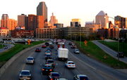
Residents utilize Interstate 35E running north-south, and Interstate 94 running east-west. Trunk highways include U.S. Highway 52, Minnesota State Highway 280, and Minnesota State Highway 5. Saint Paul has several unique roads such as Ayd Mill Road and Shepard Road/Warner Road, which diagonally follow particular geographic features in the city. Metro Transit provides bus service and connects the city to the existing Hiawatha Line light rail via dedicated bus routes but will not have its own line, the Central Line along University Avenue until 2014.[109] Downtown Saint Paul has a five mile (8 km) enclosed skyway system over twenty-five city blocks.[110] Biking is also gaining popularity due to paved bike lanes which connect to other bike routes throughout the metropolitan area.[111]
The layout of city streets and roads has often drawn complaints. Jesse Ventura brought up the city's roadways during an appearance on the Late Show with David Letterman while Governor of Minnesota.[112] Ventura later apologized for his remark that the streets had been designed by "drunken Irishmen", although people had already been complaining about the fractured grid system for more than a century by that point.[113] Some of the city road design is the result of the curve of the Mississippi River, hilly topography, conflicts between developers of different neighborhoods in the early city, and grand plans only half-realized. Outside of downtown, the roads are less confusing, but most roads are named, rather than numbered, increasing the difficulty for non-natives to navigate.[114] Due to neighborhood autonomy, some roads suddenly change names without warning.
Amtrak's Empire Builder between Chicago and Seattle stops once daily in each direction at nearby Midway Station.[115] Ridership on the train is increasing, about 6% from 2005 to over 505,000 in fiscal year 2007.[116] Increased ridership has prompted southern Minnesota leaders to plan for an expansion of Amtrak's service in the area, including an overhaul of Saint Paul's Union Depot.[116] Saint Paul is the site of the Pig's Eye Yard, a major freight Classification yard for Canadian Pacific Railway.[117] As of 2003, the yard handled over 1,000 freight cars per day.[117] Both Union Pacific and Burlington Northern Santa Fe run trains through yard, though they are not classified at Pig's Eye.[117] Burlington Northern Santa Fe operates the large Northtown Yard in Minneapolis, which handles about 600 cars per day.[118] There are several other small yards located around the city.

Saint Paul is served by the Minneapolis-Saint Paul International Airport (MSP), which sits on 3,400 acres (14 km²)[119] southwest of the city on the west side of the Mississippi River between Minnesota State Highway 5, Interstate 494, Minnesota State Highway 77, and Minnesota State Highway 62. The airport serves three international, twelve domestic, seven charter and four regional carriers[120] and is a hub and home base for Delta Air Lines, Mesaba Airlines and Sun Country Airlines.[121] Saint Paul is also served by the St. Paul Downtown Airport located just south of downtown, across the Mississippi River. The airport, also known as Holman Field, is a reliever airport, run by the Metropolitan Airports Commission. The airport houses Minnesota's Air National Guard and is tailored to local corporate aviation.[122] There are three runways that serve about 100 resident aircraft and a flight training school. The Holman Field Administration Building and Riverside Hangar are on the National Register of Historic Places.[122]
Sister cities
Saint Paul has sister cities, as designated by Sister Cities International:
 Ciudad Romero (El Salvador)
 Culiacán (Mexico)
 Changsha (China)
 Hadera (Israel)
 Nagasaki (Japan)
 Novosibirsk (Russia)
 Manzanillo (Mexico)
 Tiberias (Israel)
 Neuss (Germany)
 Modena (Italy)
See also
Footnotes
- ↑ 1.0 1.1 1.2 "American FactFinder". United States Census Bureau. http://factfinder.census.gov. Retrieved 2008-01-31.
- ↑ "The City of Saint Paul – Official website". The City of Saint Paul. 2008. http://www.stpaul.gov/. Retrieved 2008-07-30.
- ↑ "Table 2: Population Estimates for the 100 Most Populous Metropolitan Statistical Areas Based on July 1, 2006 Population Estimates: April 1, 2000 to July 1, 2006" (PDF). U.S. Census Bureau. 2007-04-05. http://www.census.gov/Press-Release/www/releases/archives/cb07-51tbl2.pdf. Retrieved 2007-04-16.
- ↑ 4.0 4.1 "Ramsey County". Metro MSP. Minneapolis Regional Chamber Development Foundation. 2008. http://www.metromsp.org/Communities/ramsey.htm. Retrieved 2008-07-30.
- ↑ Bill Salisbury (2008-08-10). "Pawlenty is latest to make Minneapolis blunder about RNC's location". Pioneer Press. http://www.twincities.com/politics/ci_10153749. Retrieved 2008-08-15.
- ↑ 6.0 6.1 6.2 Associated Press (2000-12-17). "Stars Can't Go Home Again". CBS Sports. http://www.cbsnews.com/stories/2000/12/17/sports/main257971.shtml. Retrieved 2008-07-30.
- ↑ "Some Notable U.S. Museums.". The History Channel. 2008. http://www.history.com/encyclopedia.do?articleId=226541.
- ↑ Materials Research Society (2008). "National Science Foundation Selects Museum of Science, Boston to Head $20 Million Network for Public Engagement with Nanotechnology". Press release. http://www.mrs.org/s_mrs/doc.asp?CID=6841&DID=177311.
- ↑ Capital City Partnership (2006). "A City Where People Work". Capital City Partnership. http://www.capitalcitypartnership.com/stpaulmrkt/work.shtml. Retrieved 2008-08-15.
- ↑ Galtier, Rev. Lucien (1908). Father Galtier to Bishop Grace, Prairie du Chien January 14, 1846. pp. 184–190.
- ↑ 11.0 11.1 Trimble, Steve (July 2, 2000). "A Short history of Indian Mounds Park". Neighborhood Pride Celebration. daytonsbluff.org. http://www.daytonsbluff.org/old/AShortHistoryofMoundsPark.html. Retrieved 2006-12-07.
- ↑ "Indian Mounds Park". Mississippi National River and recreation Area. National Park Service. http://www.nps.gov/archive/miss/maps/model/mounds.html. Retrieved 2006-12-07.
- ↑ 13.0 13.1 Mark Morrison (2008). "Dakota Life". City of Bloomington. http://www.ci.bloomington.mn.us/main_top/2_facilities/rec_facility/pond/signs/dakota_life/dakota_life.htm.
- ↑ Stephen Return Riggs, James Owen Dorsey (1892). A Dakota-English Dictionary. University of Michigan. http://books.google.com/?id=kKgqAAAAMAAJ&pg=PA197&lpg=PA197&dq=imniza+ska. Retrieved 2008-07-30.
- ↑ 15.0 15.1 "Lambert's Landing". National Park Services. 2006-07-27. http://www.nps.gov/miss/planyourvisit/lambland.htm. Retrieved 2008-07-28.
- ↑ "The Treaty Story". Minnesota History Center. 1999. http://www.minnesotahistorycenter.org/exhibits/territory/territory/treaty/treaty4.html.
- ↑ "Treaty with the Sioux, 1837". Dakota-Lakota-Nakota Nations. 2005-02-12. http://www.dlncoalition.org/dln_nation/1837_treaty.htm. Retrieved 2008-07-30.
- ↑ "Kaposia Village Site". Dakota County Historical Society. 2005. http://www.dakotahistory.org/county/ssp.asp. Retrieved 2008-07-30.
- ↑ Kappler, Charles J., Washington: Government Printing Office, ed (1904). Indian Affairs: Laws and Treaties. II (Treaties, 1778-1883). Oklahoma State University Library.. and "Treaty with the Sioux". 1837-09-29. http://digital.library.okstate.edu/kappler/Vol2/treaties/sio0493.htm#mn1. and "Treaty with the Sioux—Sisseton and Wahpeton Bands". 1851-07-23. http://digital.library.okstate.edu/kappler/Vol2/treaties/sio0588.htm. and "Treaty With the Sioux—Mdewakanton and Wapahkoota Bands". 1851-08-05. http://digital.library.okstate.edu/kappler/Vol2/treaties/sio0591.htm. Retrieved 2007-06-26.
- ↑ 20.0 20.1 20.2 Schaper, Julie; Horwitz, Steven (2006). Twin Cities Noir. New York, New York: Akashic Books. pp. 16. ISBN 1888451971. http://books.google.com/?id=9Yvi60c2Ax0C. Retrieved 2008-07-28].
- ↑ "Overview of the Cathedral". Cathedral of Saint Paul. 2004. http://www.cathedralsaintpaul.org/about/history.asp.
- ↑ Patricia Mougel, Dept. of French and Italian, University of Minnesota (2007-06). "Catholicisme dans le Midwest Lucien Galtier et l’origine du nom de la capitale du Minnesota" (in French) (PDF). Reflets de l'étoile du nord, Vol. 27, No. 3. http://mnaatf.org/LucienGaltierPMougel.pdf. Retrieved 2008-07-28.
- ↑ 23.0 23.1 Gilman, Rhonda R. (1989). The Story of Minnesota's Past. Saint Paul, Minnesota: Minnesota Historical Society Press. pp. 99–104. ISBN 0-87351-267-7.
- ↑ "Rolette, Jr., Joseph "Joe"". Minnesota Legislators Past & Present. Minnesota Legislature. http://www.leg.state.mn.us/legdb/fulldetail.asp?ID=14571. Retrieved 2008-07-30.
- ↑ 25.0 25.1 Mary Lethert Wingerd. "Separated at Birth: The Sibling Rivalry of Minneapolis and St. Paul". Organization of American Historians. http://www.oah.org/pubs/nl/2007feb/wingerd.html. Retrieved 2007-11-19.
- ↑ "St. Paul, Minneapolis and other cities in Minnesota suffer from gale.". GenDisasters.com. http://www.gendisasters.com/data1/mn/tornadoes/stpaul-minneapolis-tornado-aug1904.htm. Retrieved 2008-03-28.
- ↑ Regina M. Flanagan (2004-05-06). "Urban Design and Planning Studies Affecting the Western Park Neighborhood, Saint Paul, Minnesota" (PDF). Art • Landscape • Design, Saint Paul, Minnesota. http://www.publicartstpaul.org/wpna_pdfs/urbandesign.pdf. Retrieved 2008-08-03.
- ↑ "Rondo Neighborhood & the Building of I-94". Minnesota Historical Society. 2008. http://www.mnhs.org/library/tips/history_topics/112rondo.html.
- ↑ F. James Davis. "The Effects of a Freeway Displacement on Racial Housing Segregation in a Northern City". Clark Atlanta University. http://www.jstor.org/pss/273848.
- ↑ "The Jay & Rose Phillips Family Foundation Annual Report" (PDF). Jay & Rose Phillips Family Foundation. 2006. http://www.phillipsfnd.org/documents/2006_annual_report.pdf. Retrieved 2008-08-03.
- ↑ "Rondo Days official site". Rondo Avenue Inc.. http://www.rondoaveinc.org/history.html. Retrieved 2008-08-03.
- ↑ "Tallest skyscrapers of Saint Paul". Emporis. 2008. http://www.emporis.com/en/wm/ci/bu/?id=102508. Retrieved 2008-08-15.
- ↑ "Hmong Refugee Resettlement". Minnesota Council of Non-Profits. http://www.mncn.org/hmongbriefing.htm. Retrieved 2008-03-28.
- ↑ "Mississippi: River Facts". U.S. National Park Service. 2006-08-14. http://www.nps.gov/miss/riverfacts.htm.
- ↑ "St. Paul QuickFacts". U.S. Census Bureau. 2008-07-28. http://quickfacts.census.gov/qfd/states/27/2758000.html.
- ↑ Medcalf, Myron P. (2007-09-11). "St. Paul's neighborhood councils scrutinize their financial status". Star Tribune: pp. B4 Local. http://docs.newsbank.com/g/GooglePM/MN/lib00172,11997057F135EA68.html.
- ↑ "District Councils". City of Saint Paul. 2008. http://www.stpaul.gov/index.asp?nid=1859.
- ↑ "Saint Paul Participation". Citizen Participation Project Case Studies. Citizen Participation Project. http://www.cpn.org/topics/community/stpaul.html. Retrieved 2007-11-10.
- ↑ 45.4 °F for 1971 through 2000 per U.S. Census who cites "Normals 1971–2000". National Climatic Data Center. http://www.ncdc.noaa.gov/oa/climate/online/ccd/nrmavg.txt. Retrieved 2007-03-25. or 44.6 °F (7.0 °C) per Fisk, Charles (March 3, 2007). "Minneapolis-Saint Paul Area Daily Climatological History of Temperature, Precipitation, and Snowfall, A Year-by-Year Graphical Portrayal (1820–present)". http://home.att.net/~minn_climo/. Retrieved 2007-03-25.
- ↑ "Seasonal Temperature and Precipitation Information". The Weather Channel. http://www.weather.com/weather/wxclimatology/monthly/graph/USMN0664. Retrieved 2008-07-28.
- ↑ David A. Lanegran, Ph.D. (2001). "From Swede Hollow to Arlington Hills, From Snoose Boulevard to Minnehaha Parkway: Swedish Neighborhoods of the Twin Cities". Macalester College. http://www.macalester.edu/geography/courses/geog241/twincities/resident/swedehollow/swedes.htm. Retrieved 2008-07-28.
- ↑ St. Paul city, Minnesota Selected Social Characteristics in the United States: 2005-2007. United States Census Bureau. Accessed July 12, 2009.
- ↑ "District 7: Thomas-Dale or Frogtown". Ramsey County Historical Society. 2005. http://www.rchs.com/neighborhoods/frogtown.htm.
- ↑ By Tom Kenworthy (2004-11-29). "Hmong get closer look since shootings". USA Today. http://www.usatoday.com/news/nation/2004-11-29-hmong-closerlook_x.htm.
- ↑ "Hmong Resettlement Revisited". Bridging Refugee Youth and Children's Services. June 2004. http://www.brycs.org/brycs_spotjune04.htm. Retrieved 2007-11-04.
- ↑ "Saint Paul Ethnic Population Growth". City of Saint Paul. http://www.ci.stpaul.mn.us/index.asp?NID=2020. Retrieved 2007-11-06.
- ↑ Bianca Vazquez Toness (2005-05-24). "Mexican consulate opens in June". Minnesota Public Radio. http://news.minnesota.publicradio.org/features/2005/05/20_tonessb_consulate/. Retrieved 2007-11-06.
- ↑ St. Paul city, Minnesota 2005-2007 American Community Survey 3-Year Estimates. United States Census Bureau. Accessed July 12, 2009.
- ↑ St. Paul city, Minnesota ACS Demographic and Housing Estimates: 2005-2007.United States Census Bureau. Accessed July 12, 2009.
- ↑ St. Paul city, Minnesota DP-1. Profile of General Demographic Characteristics: 2000. United States Census Bureau. Accessed July 12, 2009.
- ↑ St. Paul city, Minnesota - Fact Sheet - American FactFinder. United States Census Bureau. Accessed July 12, 2009.
- ↑ "Databases, Tables & Calculators by Subject". Bureau of Labor Statistics. U.S. Department of Labor. 2008-08-26. http://data.bls.gov/PDQ/servlet/SurveyOutputServlet;jsessionid=f030f2337f5b$3F$3F$3. Retrieved 2008-08-26. This data may not be directly reproducible via this link. BLS.gov, Select "27 Minnesota" and "33460 Minneapolis-St. Paul-Bloomington, MN-WI" and all subsectors.
- ↑ Orrick, Dave (2008-07-28). "Downtown goal: Fill storefronts — at least for now". Pioneer Press (MediaNews Group). http://www.twincities.com/allheadlines/ci_10021824. Retrieved 2008-07-30.
- ↑ Johnson, Kim (2008-08-20). "Business Journal names Best Places to Work". Minneapolis / St. Paul Business Journal (American City Business Journals, Inc.). http://twincities.bizjournals.com/twincities/stories/2008/08/11/daily30.html?surround=lfn. Retrieved 2008-08-26.
- ↑ Abbe, Mary (2008-07-21). "Same old struggles at the MMAA". Star Tribune (Chris Harte): pp. 3. http://www.startribune.com/entertainment/art/25873384.html. Retrieved 2008-07-21.
- ↑ Grayson, Katharine (2007-09-14). "Lawson CEO earned $2.49M in 2007". Minneapolis / St. Paul Business Journal (American City Business Journals, Inc.). http://twincities.bizjournals.com/twincities/stories/2007/09/10/daily41.html. Retrieved 2008-08-26.
- ↑ Lavrusik, Vadim (2008-07-03). "Gander Mountain pitches blue guns at boys". Minneapolis / St. Paul Business Journal (American City Business Journals, Inc.). http://twincities.bizjournals.com/twincities/stories/2008/06/30/daily37.html. Retrieved 2008-08-26.
- ↑ Wyant, Carissa (2008-08-14). "3M to cut hundreds of jobs in coming months". Minneapolis / St. Paul Business Journal (American City Business Journals, Inc.). http://twincities.bizjournals.com/twincities/stories/2008/08/11/daily26.html?surround=lfn. Retrieved 2008-08-26.
- ↑ Moore, Janet (2008-07-16). "St. Jude Medical's product sales appear recession-proof". Star Tribune (Chris Harte). http://www.startribune.com/business/25540959.html. Retrieved 2008-07-30.
- ↑ "Locations". About St. Jude Medical. St. Jude Medical, Inc.. 2008. http://www.sjm.com/companyinformation/aboutus.aspx?section=Locations. Retrieved 2008-07-30.
- ↑ "Ford grants St. Paul plant two more years". Minnesota Public Radio. http://minnesota.publicradio.org/display/web/2008/07/24/ford_plant/. Retrieved 2008-07-23.
- ↑ "Lock and Dam 1". St. Paul District. US Army Corps of Engineers. http://www.mvp.usace.army.mil/navigation/default.asp?pageid=145&subpageid=146. Retrieved 2008-08-27.
- ↑ "History of the Saint Paul Winter Carnival". St Paul Winter Carnival. 2008. http://www.winter-carnival.com/history/.
- ↑ "Fort Snelling State Park". Minnesota DNR. 2006. http://www.dnr.state.mn.us/state_parks/fort_snelling/index.html. Retrieved 2006-12-07.
- ↑ "Harry F. Schroeder, Jr. The Kid After Whom Charles M. Schulz Named His Beethoven-Loving Character in His "Peanuts" Cartoon". Delehanty - Sullivan - Kinsman - Schroeder Family History Workspace. 2006. http://www.familyhistoryfiles.com/site_text/documents/hfs_peanuts.htm.
- ↑ PRnewswire.co.uk, "Saint Paul kicks off encore to the successful 'Peanuts on Parade' summer art project"
- ↑ "John Vachon: A Register of His Papers in the Library of Congress". Manuscript Division, Library of Congress. 2006. http://www.loc.gov/rr/mss/text/vachon.html. Retrieved 2007-10-10.
- ↑ "Ordway Center for the Performing Arts". Ordway Center for the Performing Arts. 2006. http://www.ordway.org. Retrieved 2006-12-07.
- ↑ Berryman, Don (2004-04-21). "Artists' Quarter". Jazz Police. http://www.jazzpolice.com/content/view/1381/115/. Retrieved 2008-07-30.
- ↑ Gelhhar, Jenny (2007). "The Turf Club". Features. Saint Paul Almanac. http://saintpaulalmanac.com/f-turf-club-st-paul.shtml. Retrieved 2008-07-30.
- ↑ Roseensemble.org
- ↑ "Saint Paul Chamber Orchestra Three concerts". University of Chicago. 2008. http://chicagopresents.uchicago.edu/series/stpaul/.
- ↑ "Minnesota Centennial Showboat!". University of Minnesota. 2008-07-03. http://showboat.umn.edu/.
- ↑ "Goldstein Museum of Design". College of Design. Regents of the University of Minnesota. 2008. http://goldstein.che.umn.edu/. Retrieved 2008-07-31.
- ↑ "Location and Parking". Visitor Information. Minnesota Children's Museum. 2008. http://www.mcm.org/information.shtml#location. Retrieved 2008-07-31.
- ↑ Ong, Bao (2006-07-31). "Carlson's legacy: Schubert Club: Thanks to him, once-tiny arts group attracts top artists to Twin Cities." (registration required). Pioneer Press. http://www.accessmylibrary.com/coms2/summary_0286-16156728_ITM. Retrieved 2008-07-31.
- ↑ "Schubert Club Museum of Musical Instruments". The Schubert Club. 2008. http://www.schubert.org/museum/. Retrieved 2008-07-31.
- ↑ Wyant, Carissa (2008-07-26). "St. Paul art museum loses director; searches for new home". Minneapolis St. Paul Business Journal (American City Business Journals, Inc.). http://www.bizjournals.com/twincities/stories/2008/07/21/daily1.html. Retrieved 2008-07-25.
- ↑ Abbe, Mary (2008-07-21). "Same old struggles at the MMAA". Star Tribune (Chris Harte): pp. 1. http://www.startribune.com/entertainment/art/25873384.html. Retrieved 2008-07-21.
- ↑ "St. Paul Culture:Museums". M.R. Danielson Advertising Associates. 2002. http://saint-paul.com/display.php?section=1&sub=6. Retrieved 2006-12-07.
- ↑ "Stations". Minnesota Public Radio. 2008. http://minnesota.publicradio.org/radio/stations/. Retrieved 2008-08-27.
- ↑ 82.0 82.1 "Company Information". Minnesota Public Radio. 2008. http://minnesota.publicradio.org/about/mpr/. Retrieved 2008-08-27.
- ↑ "The Fitzgerald Theater". Minnesota Public Radio. 2008. http://minnesota.publicradio.org/about/fitzgerald_theater/. Retrieved 2008-08-15.
- ↑ Schulman, Andrew. "St. Paul takes SI Sportstown Honors for the Land of 10,000 Lakes". Sports Illustrated. http://sportsillustrated.cnn.com/magazine/features/si50/states/minnesota/sports_town/. Retrieved 2007-10-30.
- ↑ Havens, Chris (2007-10-31). "In St. Paul, they're passionate about parks". Star Tribune: pp. AA1. ISSN 0895-2825. http://www.startribune.com/10242/story/1518765.html. Retrieved 2007-11-04.
- ↑ Michael Farber (2007-12-04). "In Search of... Hockeytown U.S.A.". Sports Illustrated. http://sportsillustrated.cnn.com/2007/writers/michael_farber/12/04/hockeytown1210/index.html.
- ↑ "About Xcel Energy Center". Minnesota Twins. http://www.minnesotatwinstickets.com/venues/xcel-energy-center-tickets.php. Retrieved 2007-10-30.
- ↑ "St. Paul Baseball History". St. Paul Saints. http://www.saintsbaseball.com/team/history/. Retrieved 2008-08-13.
- ↑ Sheldon, Mark (2003-02-07). "Colored Gophers made history". MLB.com. http://www.mlb.com/news/article.jsp?ymd=20030207&content_id=198142&vkey=news_mlb&fext=.jsp&c_id=null. Retrieved 2007-10-30.
- ↑ "St. Paul Twin Stars". National Premier Soccer League. http://npsl.myeliteclub.com/loadPage.aspx?iPage=301-48. Retrieved 2008-08-13.
- ↑ "About the St. Paul Curling Club". Saint Paul Curling Club. http://www.stpaulcurlingclub.org/about/history.html.
- ↑ "Minnesota Boat Club". http://www.boatclub.org/. Retrieved 2008-08-28.
- ↑ "Description of Saint Paul's Form of Government" (pdf). 2008 Mayor's Proposed Budget. City of Saint Paul. http://mn-stpaul.civicplus.com/DocumentView.asp?DID=1114. Retrieved 2007-11-10.
- ↑ "Sec. 2.01. Chief executive.". Administrative Code. City of Saint Paul. http://www.stpaul.gov/web/CityCode/ac002.html#sec2.01.. Retrieved 2007-11-10.
- ↑ "Sec. 4.01. Legislative power.". Saint Paul City Charter. City of Saint Paul. http://www.stpaul.gov/web/CityCode/ch004.html#sec4.01.. Retrieved 2007-11-11.
- ↑ "Sec. 2.01. Elective officials.". Saint Paul City Charter. City of Saint Paul. http://www.stpaul.gov/web/CityCode/ch002.html. Retrieved 2007-11-11.
- ↑ "Sec. 4.01.2. Initial districts.". Saint Paul City Charter. City of Saint Paul. http://www.stpaul.gov/web/CityCode/ch004.html. Retrieved 2007-11-10.
- ↑ "Sec. 2.02. Terms.". Saint Paul City Charter. City of Saint Paul. http://www.stpaul.gov/code/ch002.html. Retrieved 2007-11-10.
- ↑ Eric J. Ostermeier. "Twin Cities Mayoral Historical Overview" (PDF). Center for the Study of Politics and Governance. Humphrey Institute of Public Affairs. http://www.hhh.umn.edu/img/assets/23537/Twin%20Cities%20Mayoral%20Historical%20Overview.pdf. Retrieved 2008-01-01.
- ↑ "Ramsey County Home Rule Charter". Ramsey County. 2008. http://www.co.ramsey.mn.us/cb/charter/index.htm.
- ↑ "Ramsey County Building Locations". Ramsey County. 2008. http://www.co.ramsey.mn.us/pm/location.asp.
- ↑ "Minnesota Senate Maps & Data". Geographic Information Services. Minnesota State Legislature. 2007. http://www.commissions.leg.state.mn.us/gis/senmapdata.htm. Retrieved 2008-07-24.
- ↑ "Minnesota House Maps & Data". Geographic Information Services. Minnesota State Legislature. 2007. http://www.commissions.leg.state.mn.us/gis/hsemapdata.htm. Retrieved 2008-07-24.
- ↑ El Nasser, Haya (2004-04-11). "Most livable? Depends on your definition". USA TODAY. http://www.usatoday.com/news/nation/2004-04-11-most-livable_x.htm. Retrieved 2007-10-16.
- ↑ "Post-Secondary Schools". Minnesota Department of Education. 2005. http://app.education.state.mn.us/Directories/report_e8.jsp. Retrieved 2007-03-24.
- ↑ Saint Paul Public Schools. "About Us". http://www.spps.org/About_Us2.html. Retrieved 2007-06-08.
- ↑ "Charter School Facts". MN Association of Charter Schools. http://www.mncharterschools.org/page/facts.jsp. Retrieved 2007-11-06.
- ↑ Minnesota Department of Education (2005). "Alphabetical List of Nonpublic Schools". http://app.education.state.mn.us/Directories/report_c14.jsp. and "Charter Schools". 2005. http://app.education.state.mn.us/Directories/report_c11.jsp. Retrieved 2007-06-08.
- ↑ "Central Corridor next steps and timeline". Metropolitan Council. April 2, 2007. http://www.metrocouncil.org/transportation/ccorridor/centralcorridor.htm. Retrieved 2007-04-11.
- ↑ Gill, N.S.. "Skyways: Downtown Minneapolis and St. Paul Skyways". About.com. About, Inc., The New York Times Company. http://minneapolis.about.com/od/travelweather/a/skyways.htm. Retrieved 2007-03-15.
- ↑ "Bike-n-Ride by bus". Metro Transit. http://www.metrotransit.org/serviceInfo/bikeByBus.asp. Retrieved 2007-09-20.
- ↑ Khoo, Michael (2002-12-15). "The days of Jesse". Minnesota Public Radio. http://news.minnesota.publicradio.org/features/200212/16_khoom_ventura/. Retrieved 2007-09-16.
- ↑ "Gov. Ventura Stumbles". New York Times. 1999-02-06. http://query.nytimes.com/gst/fullpage.html?res=9B07E3DD173CF935A15751C0A96F958260&n=Top/Reference/Times%20Topics/People/V/Ventura,%20Jesse. Retrieved 2007-09-16.
- ↑ L. Empson, Donald (2006). The Street Where You Live. University of Minnesota Press page. pp. 17. ISBN 978-0-8166-4729-3.
- ↑ "St. Paul-Minneapolis, MN (MSP)". Amtrak. http://www.amtrak.com/servlet/ContentServer?pagename=Amtrak/am2Station/Station_Page&c=am2Station&cid=1080080551718&ssid=85. Retrieved 2007-04-26.
- ↑ 116.0 116.1 Sommerhauser, Mark (2008-07-24). "Mayors claim more riders should spur more service on Amtrak line". The Winona Daily News (Lee Enterprises). http://www.winonadailynews.com/articles/2008/07/24/news/00lead.txt. Retrieved 2008-07-25.
- ↑ 117.0 117.1 117.2 Rhodes, Michael (2003). North American Railyards. Saint Paul, Minnesota: MBI Publishing Company. pp. 128. ISBN 0-7603-1578-7.
- ↑ Rhodes, Michael (2003). North American Railyards. Saint Paul, Minnesota: MBI Publishing Company. pp. 16. ISBN 0-7603-1578-7.
- ↑ "History and Mission". Metropolitan Airports Commission. http://www.mspairport.com/mac/organization/History.aspx. Retrieved 2007-06-27.
- ↑ "A History of Minneapolis: Air Transportation". Minneapolis Public Library (mpls.lib.mn.us). 2001. http://www.mpls.lib.mn.us/history/tr5.asp. Retrieved 2007-02-12.
- ↑ "Pilot Groups". Air Line Pilots Association. http://www.alpa.org/?tabid=183. Retrieved 2007-03-15.
- ↑ 122.0 122.1 "St. Paul Downtown Airport". Metropolitan Airports Commission. http://www.mspairport.com/relievers/st_paul/default.aspx. Retrieved 2007-11-19.
External links
- City of Saint Paul – Official site
- City of Saint Paul – Department of Parks and Recreation, a list of city parks, programming, recreation centers, opening hours and other information.
- Official Tourism site – Visitor Information
- Saint Paul Almanac - Singular guidebook to Minnesota's capital city
- List of Saint Paul buildings, places and tours on Placeography
- Ramsey County and St. Paul Historical Society
- Saint Paul travel guide from Wikitravel
|
||||||||||||||||||||
|
||||||||||||||||||||
|
||||||||


